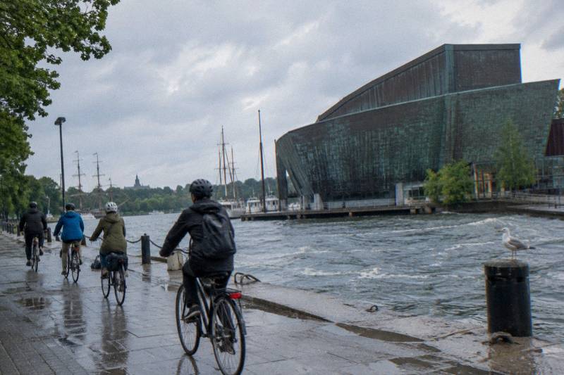
Where Are The Bike Lanes In Stockholm?
A plain answer to where Stockholm's bike lanes run, which districts have the best paths, the 2026 projects reshaping them, and how a guided ride helps you find the network fast.
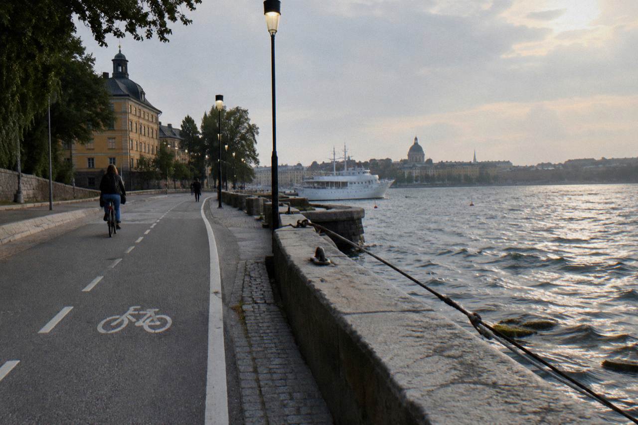
Stockholm is one of those cities where the cycling infrastructure quietly outgrew the postcard reputation. The city states it has roughly 117 mil of cycle routes, which is about 1,170 km, spread over fourteen islands, and it keeps adding to them: a new counter-flow lane opened on Vasabron in June 2026, wide lanes arrived on Sveavägen in May 2026, and a widened canal-side path at Riddarholmen opened two months ahead of schedule. This article answers where the lanes are, which districts reward a cyclist most, what the rules are once you are on them, and how a guided ride helps you learn the network in a single morning. If you're still weighing whether to explore the islands on two wheels, this honest assessment of Stockholm's bike friendliness covers the hills, the traffic and the seasons in detail.
Stockholm's bike lanes run city-wide, with roughly 1,170 km of dedicated cycle paths, combined pedestrian and cycle paths, and painted cycle lanes, of which about 36 mil form the primary commuter corridors. The densest visitor riding sits on the central islands: Norrmalm, Kungsholmen, Södermalm, Gamla Stan and Djurgården are all linked by separated lanes and dedicated bridges. No single map is printed on this page, so treat this as the layout, not the route sheet. To turn that layout into an actual day of riding, the guide to self-guided bike touring in Sweden covers what you can plan on your own and where guided rides still help.
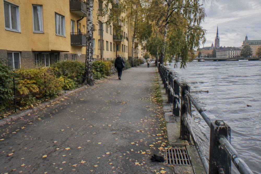
The city's own cycling portal, Cykla Stockholm, is the primary source for the network figures and the authoritative place to plan a route. It describes the roughly 117 mil figure as the total of dedicated cycle paths, combined pedestrian and cycle paths, and marked cycle lanes, with about 36 mil designated as primary routes. For a visitor that split matters more than the raw number: the primary corridors are the ones that are widest, most consistently maintained, and most likely to be swept and salted in winter.
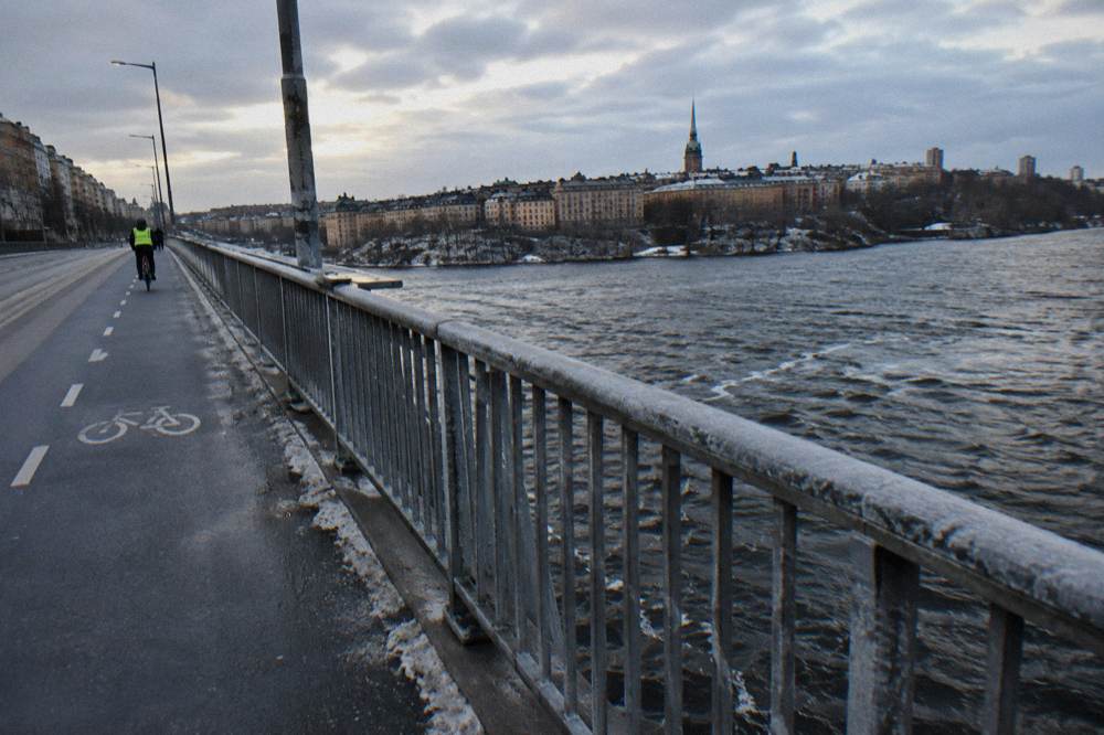
Geographically the network follows the water. Because Stockholm is built on islands, the cycling experience is defined by bridges rather than arterial roads. Vasabron gained a new northbound cycle lane in June 2026, converting what had been a narrow two-way lane into a wider one-way path as part of a continuous central corridor. Slussbron carries cyclists between Södermalm and Gamla Stan today, with a single 3 m eastbound lane and a double 6 m westbound one, and the city plans a new pedestrian and cycle bridge over Söderström opening in early 2027. Reading the water and the bridges is genuinely how locals navigate by bike.
Two cautions keep this honest. First, Gamla Stan's inner streets are pedestrian streets: cycling is permitted at walking pace and you must yield to pedestrians, and the city's rules there have tightened recently. Our Gamla Stan bike route guide covers how to ride that district without breaking the pace rules. Second, a lane existing does not mean a lane is wide, dry or open; construction works temporarily close sections every season, and we cover the current ones below.
If you would rather have a guide lead you through the network than decode it yourself, a shared guided ride is the shortcut. Prices and meeting points sit on the booking pages, and checking them takes less time than planning a first route across four islands alone.
Which Districts Have The Best Cycle Paths?
Södermalm and Kungsholmen currently offer the most improved riding, with new wide lanes on Sveavägen's northern stretch feeding Kungsholmen and a "green wave" on Södermalm timed at 20 km/h. Norrmalm carries the widest commuter corridors, while Djurgården's park paths reward slower riding and Gamla Stan requires walking pace on its pedestrian streets. Each district has a distinct character, so pair the district to your pace.
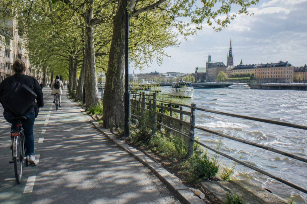
Södermalm got a genuine upgrade in 2026. The city introduced a green wave for cyclists on sections of Hornsgatan and Långholmsgatan, timed so a rider holding about 20 km/h catches successive green lights during weekday peak periods. The island is also slated for a new cycle lane and cycle street on Ringvägen between Hornsgatan and Tantogatan, with implementation decided in 2026 and completion preliminarily set for 2027. For hill-weary visitors, our Södermalm by bike guide explains why the southern heights reward an e-bike, and the e-bike rules below explain what that means legally.
Norrmalm and the approach to it are where the big commuter money went. Sveavägen received new 2.5 m wide cycle lanes between Mäster Samuelsgatan and Odengatan, finished in May 2026, alongside wider pavements and fewer car lanes. On the Kungsholmen side, Sankt Eriksgatan is getting new and wider cycle lanes between Fleminggatan and Sankt Eriksbron, started in August 2026 with completion expected in autumn 2027, and the Sankt Eriksbron renovation that began in autumn 2026 includes wider cycle lanes, though it runs to winter 2028.
Djurgården is different: a royal park rather than a commuter corridor, with free-to-ride park roads and paths that the fresh reporting still recommends exploring by bicycle. Note that the vehicle barriers at Djurgårdsbommen and Vasabommen closed those points to most vehicles on a seasonal schedule in 2026, which makes the island calmer, not closed, for cyclists. Our Djurgården by bike guide lays out the island, and if you cross from Slussen the ferry takes bikes at no extra cost subject to space, which we cover fully in the Djurgården ferry article.
| District | Cycle lane character | What changed recently | Best ridden as |
|---|---|---|---|
| Södermalm | Green-wave corridors at 20 km/h, hill climbs | Green wave on Hornsgatan and Långholmsgatan; Ringvägen lane planned | E-bike or classic, unhurried |
| Kungsholmen | Commuter lanes around the island, bridge links | Sankt Eriksgatan widening to autumn 2027; Sankt Eriksbron to winter 2028 | Steady city riding |
| Norrmalm | Widest central corridors | Sveavägen 2.5 m lanes finished May 2026; Vasabron lane June 2026 | Direct cross-city riding |
| Gamla Stan | Pedestrian streets, walking pace | Riddarholmskanalen path widened, opened April 2026 | Slow, walking pace in the core |
| Djurgården | Park roads and paths, no barrier for cyclists | Seasonal vehicle barriers at Djurgårdsbommen and Vasabommen | Leisurely loop riding |
Want Someone Else To Find The Lanes For You?
A guided ride is the fastest way to learn where the lanes run, because a local guide picks the corridor, the bridge crossings and the pace for you. Stockholm at a Glance is a 2 to 3 hour shared classic-bike tour that covers the central islands in one loop, with the bike included per the listing. The current price, meeting point and availability are on the booking page rather than repeated here.
The value of a guide on this specific question is route knowledge. A first-time visitor planning solo has to work out which bridges have usable lanes, where Gamla Stan's pedestrian rules begin, and which construction detours are active this month. A guide has already done that, and the listing format means you spend your three hours riding rather than route-checking at intersections. Riders who prefer to keep their own company can compare formats in our guided ride versus rental analysis before deciding.
The same logic applies at the city's edges. For riders curious about the forested north and east rather than the islands, the Forest Bike Tour with Sauna and Homemade Lunch is a 5 hour shared classic-bike ride that trades city lanes for woodland trails, with sauna and a cooked lunch described in the listing. Check the booking page for the price and what the day looks like in the current season.
What Are The Cycle Lane Rules Once You Are On Them?
Use the cycle path where one exists, keep right, and respect walking-pace zones: cycling on a pavement where it is prohibited carries a 500 kr fine, exceeding walking pace on a pedestrian street 1,000 kr, and running a red light on a bike 1,500 kr. Helmets are mandatory only for riders under 15, and bikes must always have a working bell and brakes. Lights are required in darkness only.
These figures come from the police and the Swedish transport agency, and the fines are in Swedish kronor. The transport agency's rule is plain: "Om det finns en cykelbana, ska du normalt använda den", if there is a cycle path you should normally use it, and keep right when you do. The full rule set, including the e-bike definition, sits on the Transportstyrelsen cycle page.
The e-bike definition matters if you rent one, because it decides whether you are legally a cyclist at all. Pedal assistance that cuts out at 25 km/h with a motor of at most 250 W continuous rated power counts as an ordinary bicycle; anything beyond that is treated as a moped with different requirements. Shared e-scooters follow their own class at 20 km/h and 250 W, and in Gamla Stan they are banned except along Munkbroleden and Skeppsbron per city rules reported in October 2026. Our cycling rules guide carries the complete fine table and helmet law detail, including the 500 kr light fine for riding unlit in darkness.
| Situation | Rule | Fine if broken |
|---|---|---|
| Riding on a pavement where cycling is not allowed | Prohibited use of the wrong part of the carriageway | 500 kr |
| Faster than walking pace on a pedestrian street | Yield to pedestrians, walking pace | 1,000 kr |
| Running a red light on a bike | Standard signal compliance | 1,500 kr |
| Ignoring a stop sign | Standard sign compliance | 1,000 kr |
| Riding against a one-way street | Wrong direction | 500 kr |
| Missing bell or brake | Mandatory equipment at all times | 500 kr |
| No lights in darkness | White or yellow front, red rear, visible at 300 m | 500 kr |
One Gamla Stan detail is worth its own sentence: the city's rules there report all inner streets as pedestrian streets with a 24/7 parking ban, vehicle traffic prohibited from 11:00 to 06:00 without a permit, and through traffic forbidden between 06:00 and 11:00 except deliveries. Cyclists may use the pedestrian streets but must ride at walking pace and give way to everyone on foot. Stortorget, the main square, received new low granite planters as vehicle barriers installed across October and November 2026, ahead of the Christmas market season.
Which Lane Projects Should You Know About Right Now?
Three projects define the near-term network: a new cycle lane and cycle street on Ringvägen decided in 2026 and preliminarily finished in 2027, the Sankt Eriksbron renovation with wider cycle lanes running to winter 2028, and a new pedestrian and cycle bridge at Slussen planned to open in early 2027. The Riddarholmskanalen path widening already opened in April 2026, two months early. Expect detours around active works rather than closed districts.
Construction is the honest caveat to any lane map. During the Riddarholmskanalen works the cycle lane between the Gamla Stan metro and Vasabron was closed with detours via Munkbron, and that project finished early; the pattern of closing a lane, signing a detour and reopening wider is now standard city practice. In Norra Djurgårdsstaden, path closures along Lidingövägen run from 14 September to 14 December 2026, while a new cycle and pedestrian path on Bobergsgatan completes in autumn 2026.
The wider programme continues beyond the centre. The city decided in October 2026 on a new pedestrian and cycle path between Märsta and Odensala in Sigtuna, with construction from 2027 and completion by 2028 at the latest. The first line of the "Stockholm cycle lane" wayfinding concept, the Hässelby corridor into the city, opened in May 2026 with new signs, distance markings and road painting, which is the city signalling that route-finding by bike is meant to get easier. On Södermalm, planning resumed in September 2026 for a cycle path along road 262 north of the city, with a possible 2029 start and 129 mnkr of financing in the regional plan.
For planning purposes, treat week-to-week closures as background noise rather than obstacles. The city's traffic information service, Trafiken.nu, lists active works in central Stockholm, and its October 2026 note confirmed no Gamla Stan or Djurgården cycle bans beyond the general rules. If a listed detour matters to your day, the guided tours above handle it by simply routing around it, which is one of the quieter arguments for a guide.
Do The Bike Lanes Stay Usable In Winter?
Yes, on the priority network: the city sweeps and salts roughly 38 mil of cycle paths, around 20 mil of it combined pedestrian and cycle paths, prioritised for bare-ground conditions down to about -6 C. November averages a 5.4 C high and December a 2.5 C high with under 48 mm of precipitation each, so lanes are typically rideable, though daylight shrinks to under 8 hours and lights become legally required.
Those temperature and precipitation figures are SMHI 1991 to 2020 normals for Stockholm, not a forecast, and they describe a winter that is milder than most visitors expect. The first snow lying at least 1 cm deep in Stockholm falls, on SMHI statistics, around 26 November on average, and the season's totals are modest: winter averages 113 mm of precipitation across December to February. The catch is light. By November the day is down to roughly 7.7 hours of daylight and December to 6.2, so the darkness-only lighting law stops being theoretical and becomes a daily requirement.
The winter riding culture is real enough that operators sell it: winter e-bike tours with studded tires and gear provided are available from July 2026 availability listings onward, and fat-bike forest rides with sauna and lunch run year-round on seasonal trails. Our rain and weather guidance and the month-by-month weather breakdown cover what to wear and when, and the best time of year to cycle guide ranks the season, with May to September the comfortable consensus.
How Do You Actually Plan A Ride On The Network?
Start from the primary corridors, cross islands by bridge rather than by transit, and remember that full-size bikes are banned on SL buses, the metro and the city trams, with limited access on commuter trains and Tvärbanan outside rush hours. The Djurgården ferry takes bikes at no extra cost subject to space. If any detail matters to your route, the city's cycling portal and the operator booking pages are the two places to confirm it.
The transit rule surprises visitors more than any lane layout does. A regular bike may never be taken on SL buses, the metro, Spårväg City or the other city light-rail lines, per the SL rules; commuter trains, Tvärbanan outside rush hours, Saltsjöbanan, Lidingöbanan and Roslagsbanan allow non-electric bikes with limitations, and e-bikes are prohibited on Tvärbanan at all times. The practical consequence is that a cycling day in Stockholm should be planned as a loop, not as a bike-plus-metro combo.
Ferry crossings are the exception, and a pleasant one. The Djurgården ferry, SL line 82 from Slussen, is a commuter boat that takes bikes at no extra charge when there is space, with staff judging fit and e-bikes placed on deck. In Gamla Stan, the loop is best closed on foot at walking pace, which is also the law there.
For riders who want the network explained while riding it rather than from a screen, the guided formats remain the efficient choice. Stockholm Bike Tours exists because the lanes are genuinely good and genuinely undocumented for visitors, and a 2 to 3 hour guided loop across the central islands teaches the corridors, bridges and pace rules faster than any afternoon of solo trial and error.
Common Questions About Stockholm Bike Lanes
Where Are The Bike Lanes In Stockholm?
They run city-wide: about 1,170 km of dedicated paths, combined paths and painted lanes in total, with roughly 36 mil of primary corridors. The densest visitor riding links Norrmalm, Kungsholmen, Södermalm, Gamla Stan and Djurgården, mostly by separated lanes and dedicated bridge crossings such as Vasabron and Slussbron.
Is There A Stockholm Bike Lanes Map?
Yes, the city publishes route information on its cycling portal, Cykla Stockholm, which is the authoritative source for the network figures and primary routes. This page does not reproduce or host a map, so plan from the portal directly, or let a guided tour handle the routing for you.
Do You Have To Use The Cycle Path If One Exists?
Yes, normally. The transport agency's rule is that where a cycle path exists you should normally use it, and keep right. Fines apply for riding on the wrong part of the carriageway, and on pedestrian streets such as Gamla Stan's core you must ride at walking pace and yield to pedestrians.
Are Stockholm Bike Lanes Cleared In Winter?
The priority network is. The city sweeps and salts roughly 38 mil of cycle paths for bare-ground conditions down to about -6 C, prioritising commuter corridors. November and December normals sit at 5.4 C and 2.5 C average highs, so riding is common, but lights are legally required in darkness.
Can You Take A Bike Between The Islands Without Riding?
Only partly. Full-size bikes are banned on SL buses, the metro and the city trams, with limited access on commuter trains and Tvärbanan outside rush hours. The Djurgården ferry takes bikes at no extra cost subject to space, which is the one transit crossing that genuinely helps a cycling day.
Is A Guided Tour A Good Way To Learn The Lanes?
It is the fastest way. A shared guided ride of 2 to 3 hours crosses the central islands on the working corridors with a local choosing the route, which sidesteps the detours, pace zones and bridge choices a first-time visitor would otherwise solve alone. Prices and meeting points sit on the booking pages.